1
/
of
2
julianbook
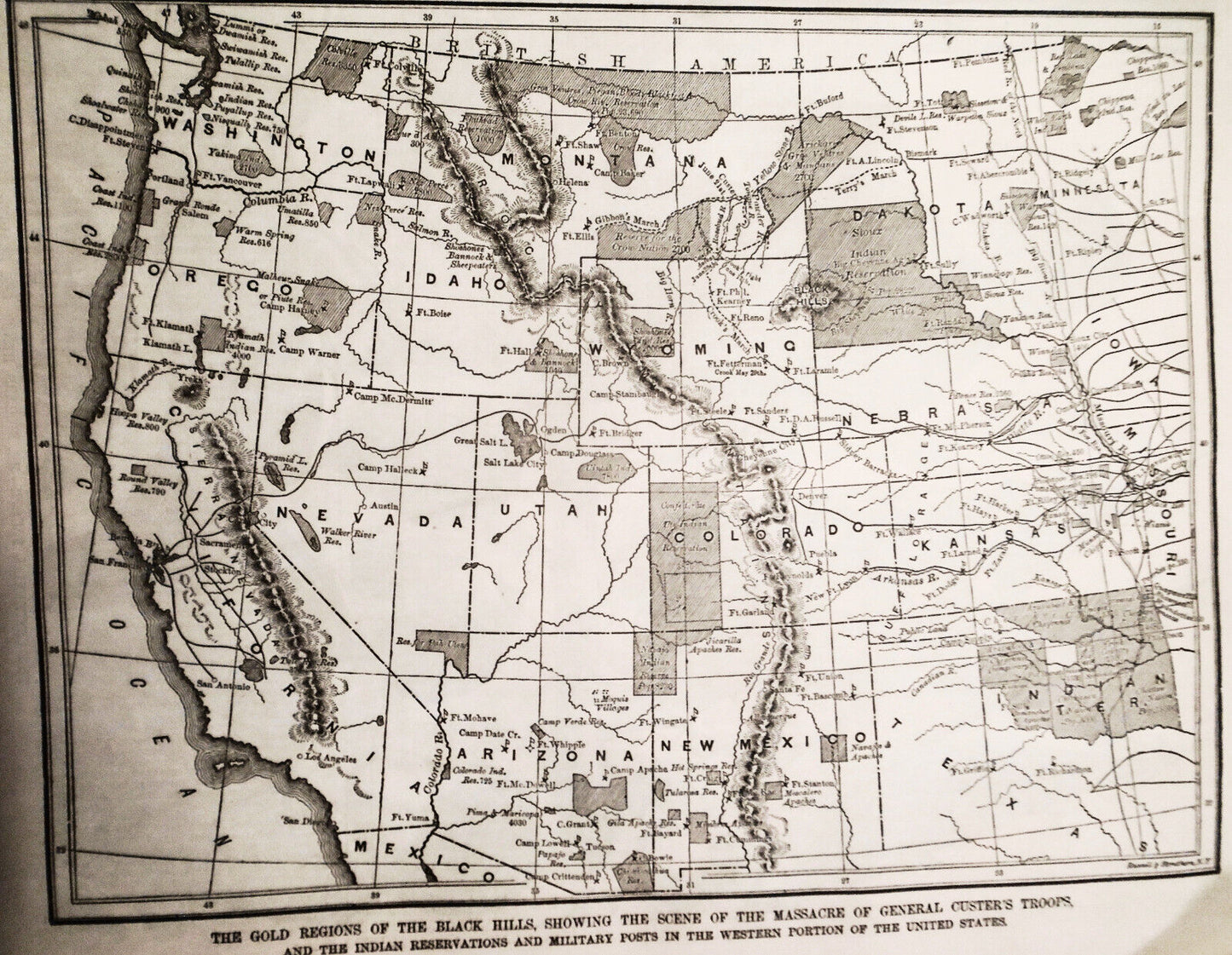
1876 Gold Regions of Black Hills, Scene of Massacre of General Custer's Troops
1876 Gold Regions of Black Hills, Scene of Massacre of General Custer's Troops
Regular price
$36.00 USD
Regular price
Sale price
$36.00 USD
Unit price
/
per
Shipping calculated at checkout.
Couldn't load pickup availability
Original map from Harper's Weekly, July 23, 1876
" The Gold Regions of the Black Hills, Showing
the Scene of the Massacre of General Custer’s Troops, and the Indian
Reservations and Military Posts in the Western Portion of the United
States ."
Map shows in tremendous detail the entire area
over which the Indian Wars took place, with particular notations
concerning the operations leading up to Custer’s defeat. This map is
titled " The Gold Regions of the Black Hills, Showing the Scene of the
Massacre of General Custer’s Troops, and the Indian Reservations and
Military Posts in the Western Portion of the United States ." From
Oregon, Montana and Dakota, down to California, Nevada, Utah, Colorado,
Nebraska, Kansas, Arizona, New Mexico, Texas, and the Indian Territory,
this shows
towns,
forts and military installations, as well as rivers and other
geographical features. It also shows the Indian reservations throughout
this region and where various tribes were located. And it shows such
details as "Terry’s March" and "Gibbon’s March" and "Crook’s Fight" - as
well as the location of "Custer’s defeat!
Approx: 9 x 7 inches
Listed with ExportYourStore.com
Share


